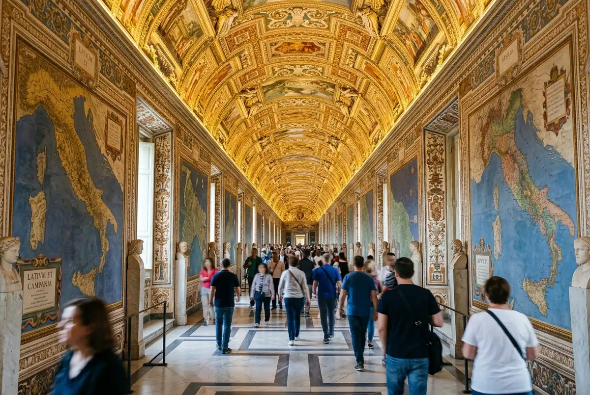
The Gallery of Maps at the Vatican Museums is a 120 metre corridor lined with 40 painted topographical maps of Renaissance Italy, commissioned by Pope Gregory XIII in the 1580s and painted based on surveys by the geographer Ignazio Danti. Here’s what I’d actually do before you walk through: slow down, because most visitors treat this corridor as a hallway between the Gallery of Tapestries and the Raphael Rooms rather than a highlight in its own right, and that’s a genuine mistake given how much is packed into each panel. My what to see in the Vatican Museums highlights guide covers where this stop fits into the rest of the route, and the current vatican pass ticket lineup on the homepage covers the ticket side if you haven’t booked yet.
What exactly is the Gallery of Maps?
Forty painted panels, each depicting a different Italian region as it was understood in the late 16th century, arranged geographically down both walls of the corridor so that the layout roughly mirrors Italy’s actual geography, split along the peninsula’s central spine. The maps were remarkably accurate for their era, based on real surveying work rather than artistic guesswork.
I’d tell anyone walking through that the accuracy is genuinely the point here, more than the decorative painting style. This was a serious cartographic project dressed up as fresco, and knowing that changes how the corridor reads once you’re standing in it.
Why do visitors usually rush past it?
Because it connects two more famous stops, the Gallery of Tapestries behind you and the Raphael Rooms ahead, and the anticipation of reaching the Sistine Chapel pulls most visitors forward without stopping. I’ve watched entire tour groups cross the full 120 metres in under three minutes, which barely gives you time to register that the maps are even individually different.
My honest take: this is one of the most underrated stops on the entire route precisely because of how quickly people move through it. I’d actively slow your own pace here even if a guide or a group is pulling you forward.
What’s on the ceiling, and why does it matter?
A gilded, heavily decorated ceiling runs the full length of the corridor, painted with additional scenes and ornamentation that most visitors never look up to see, since their attention stays locked on the wall panels at eye level. I’d call this one of the more consistently missed details anywhere in the Vatican Museums.
I’d genuinely stop, look straight up for a moment, and then go back to the maps. The contrast between the precise, restrained cartography on the walls and the ornate gilding overhead is part of what makes the room work as a complete space rather than just a corridor of pictures.
How much time should you spend here?
I’d budget at least 10 minutes, more if you’re genuinely interested in historical cartography or Italian geography. That’s longer than most visitors give it, and I think it’s worth pushing back against the crowd’s natural pace to get it.
If your schedule is tight and something has to give, I’d protect time here before the Gallery of Tapestries, since the maps reward close attention in a way that’s harder to replicate later if you skip it now on a rushed visit.
How does the Gallery of Maps fit into the rest of the visit?
It sits between the Gallery of Tapestries and the Raphael Rooms on the standard museum route, which puts it roughly two-thirds of the way through the journey toward the Sistine Chapel. My Raphael Rooms guide covers what comes right after, and my Sistine Chapel ceiling guide covers the room this whole stretch of the visit is building toward.
I’d read both if you want to understand how these three highlights connect as one continuous experience, since they’re rarely appreciated as a sequence the way I think they deserve to be.
What I’d tell a first-time visitor
Don’t let the crowd’s pace decide how long you spend here. The Gallery of Maps holds up under close attention better than almost any other stop on the route, and it’s genuinely one of my favorite rooms in the whole complex precisely because so few visitors give it the time it deserves. For more on the room’s history and the cartographer behind it, the Gallery of Maps entry at Wikipedia is a solid place to read further.
If you only remember one thing from this page, let it be this: look up at the ceiling at least once. It’s the single most consistently missed detail I’ve noticed visitors walk past in this entire corridor.
Frequently asked questions
How many maps are in the Gallery of Maps?
Forty painted panels, each depicting a different Italian region, commissioned by Pope Gregory XIII in the 1580s and based on surveys by the geographer Ignazio Danti.
How long is the Gallery of Maps corridor?
About 120 metres, making it one of the longer single galleries on the standard Vatican Museums route.
Is the Gallery of Maps worth stopping for?
Yes, genuinely more than most visitors expect. It’s an easy stop to rush through since it connects two more famous rooms, but the detail in the individual panels rewards a slower look.
Where is the Gallery of Maps on the museum route?
It sits between the Gallery of Tapestries and the Raphael Rooms, roughly two-thirds of the way through the standard route toward the Sistine Chapel.
What’s on the ceiling of the Gallery of Maps?
A gilded, ornately decorated ceiling runs the full length of the corridor. Most visitors never look up to see it since their attention stays on the wall panels.